

Mars Xplorer

คำอธิบายของMars Xplorer
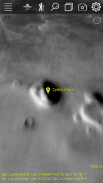
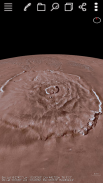
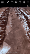
Join the fun! This application lets you view the terrain of the planet mars in 3D. Data from NASA and USGS combined with Deep Learning Artificial Intelligence Swarm works together to give you the best real experience and extend your smart phone capabilities. The AI is new and can detect structures on the surface. The default color layer shown is 323m/pixel but there is a higher resolution radar grey 100m/pixel. It allows you to zoom down to the surface and roam around like a rover. You can fly over interesting areas using our "Trek" capability. You can quickly create your own custom Treks anywhere on Mars fly over them and save them for use anytime! You can select one of our GPS Tracks or add your own then fly over automatically using that track selecting your altitude and rate. Lists of locations on the planet are available from us or you enter and zoom to the longitude/latitude you enter. Multiple layers of terrain information can be overlapped and transparency control for each layer is provided.
It is best to use an internet connection through a WiFi router and we tested with 2GB of CPU Memory and large pixel count but it might be okay with 1GB and low pixel resolution but not with 500MB of CPU Memory. We support Android 5.1+.
ร่วมสนุก! โปรแกรมนี้จะช่วยให้คุณดูภูมิประเทศของดาวอังคารดาวเคราะห์ในแบบ 3 มิติ ข้อมูลจากองค์การนาซ่าและ USGS รวมกับลึกการเรียนรู้ปัญญาประดิษฐ์ Swarm ทำงานร่วมกันเพื่อให้คุณได้ประสบการณ์จริงที่ดีที่สุดและขยายขีดความสามารถมาร์ทโฟนของคุณ เอไอใหม่และสามารถตรวจสอบโครงสร้างบนพื้นผิว ชั้นสีเริ่มต้นที่แสดงเป็น 323m / พิกเซล แต่มีความละเอียดสูงกว่าเรดาร์สีเทา 100m / พิกเซล จะช่วยให้คุณซูมลงไปที่พื้นผิวและเดินเตร่ไปรอบ ๆ เหมือนรถแลนด์โรเวอร์ คุณสามารถบินผ่านพื้นที่ที่น่าสนใจโดยใช้ "ค" ของเราความสามารถ คุณได้อย่างรวดเร็วสามารถสร้างเส้นทางเดินของคุณเองได้ทุกที่บนดาวอังคารบินอยู่เหนือพวกเขาและช่วยให้พวกเขาสำหรับการใช้งานได้ตลอดเวลา! คุณสามารถเลือกหนึ่งของเพลงจีพีเอสของเราหรือเพิ่มของคุณเองแล้วบินผ่านโดยอัตโนมัติโดยใช้การติดตามว่าการเลือกความสูงและอัตราของคุณ รายชื่อสถานที่ในโลกที่มีอยู่จากเราหรือคุณป้อนและซูมไปที่เส้นแวง / ละติจูดคุณป้อน หลายชั้นของข้อมูลภูมิประเทศสามารถซ้อนทับและการควบคุมความโปร่งใสสำหรับแต่ละชั้นมีให้
ที่ดีที่สุดคือการใช้การเชื่อมต่ออินเทอร์เน็ตผ่านเราเตอร์ WiFi และเราทดสอบกับหน่วยความจำ 2GB CPU และจำนวนพิกเซลที่มีขนาดใหญ่ แต่มันอาจจะโอเคกับ 1GB และความละเอียดของพิกเซลต่ำ แต่ไม่ได้มีหน่วยความจำ 500MB ของ CPU เราสนับสนุน Android 5.1 +


